Thursday, 25 October 2012

To Thorung Phedi and High Camp

The three days from Manang to High Camp were characterized by a series of relatively short treks, punctuated by long periods of inactivity at our destinations.  While the “rule of threes” prescribed an ascent of no more than 300 metres a day, the contour interval between settlements made adherence to this tricky.  Fortunately, trekking time was now truncated to no more than 5 hours a day (at worst) though in places the physical exertion was even higher than it had been on day two.  I found negotiating suspension bridges a particular challenge.  Setting a rhythm on the trail proved relatively easy – a simple plod stabilised by ones trekking poles ensured minimum expenditure of energy.  But bridges were another matter.  For one thing, they had a tendency to sway just enough to knock one off one’s rhythm.  For another, the “downhill” part of the traverse was soon followed by a curiously taxing incline that sapped the lungs and made the muscles smart.  Invariably, the exits to suspension bridges were bottlenecked by heaving pelotons of huffing, puffing trekkers.
  
Typical dwelling of the Manang area - wood is piled up on the roof in anticipation of winter.  Such piles are an outward sign of wealth, prestige and status in the community

Travelling above the tree line, we now beheld a form of alpine desert where the rocky ground sustained little more than a species of coarse grass (upon which the Yaks and Musk Deer graze) and a ubiquitous thorny scrub called Seabuck Thorn.  The plant bears a perennial orange berry that is said to contain the highest concentration of vitamin C and Lycopene in the plant kingdom.  This fruit is painstakingly picked, mashed to a pulp and strained by hand to distil a bright orange juice.  The splendid beverage is served hot to thirsty trekkers and is the closest I’ve seen to magic potion.  Three days later after the harrowing descent from the Thorung La to Muktinath I sampled a cup and felt the life returning with almost every sip.  My only regret is that I didn’t discover its life giving properties sooner.


Men churning Nak milk

Yak Meadow near Gudrung

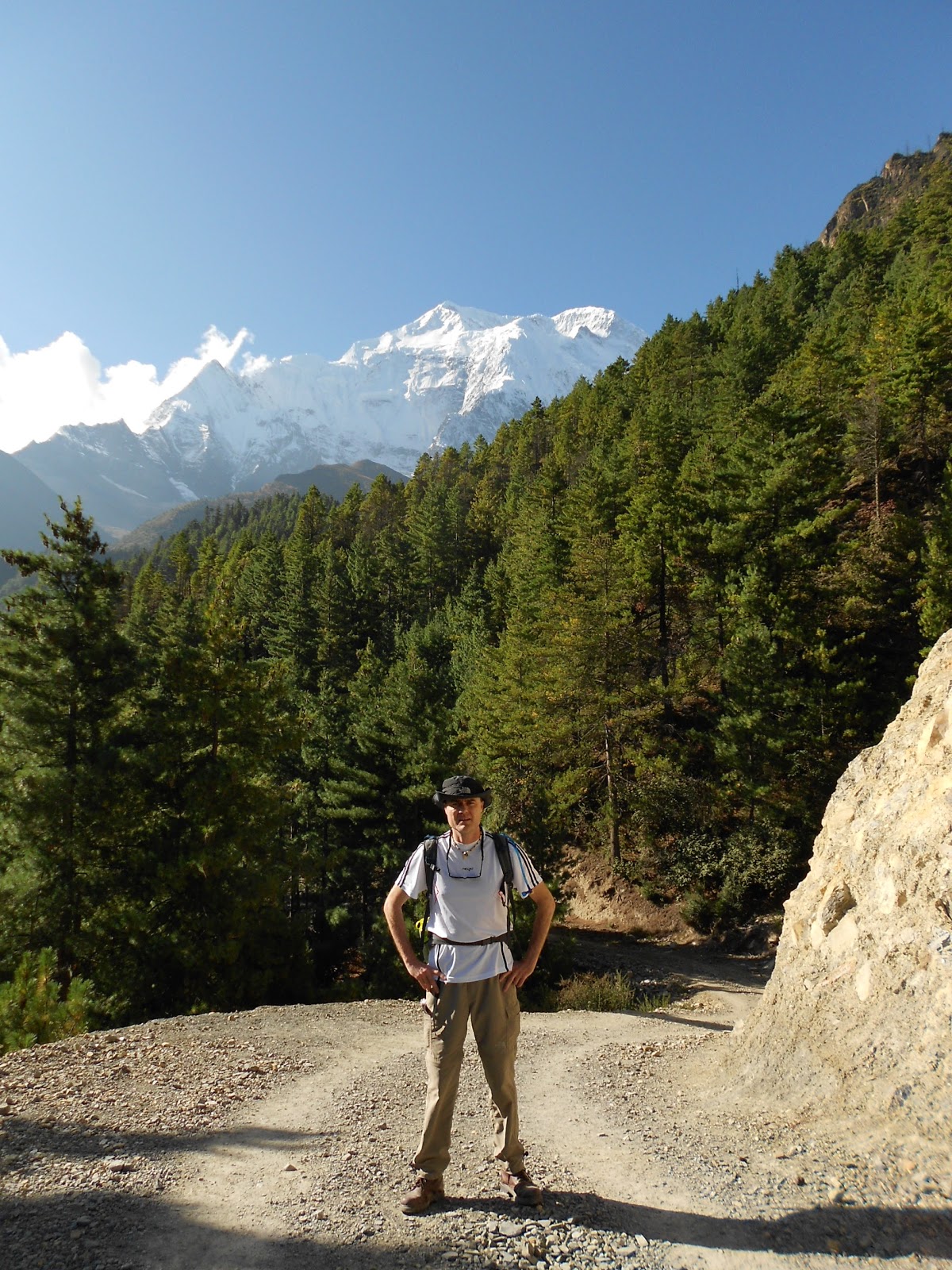
Tea break with Gangapurna in the background

Dutch trekker Sander and his guide Tilak

Another memory of this leg was the increasingly spartan nature of the villages we encountered.  Lodges were increasingly exposed to the elements and we quickly layered up against the escalating cold.  Upon arrival, we would eat lunch and then rest up on our beds, reading and chatting.  Though the morning weather was invariably pristine, afternoon activities might be curtailed by low-lying cloud, high winds, sleet and in places, light snow.  The enveloping cloud had a distorting and spooky effect on sound too.  The soporific clanging of bells announced the occasional passing of yak, pony or donkey trains and occasionally the mournful cry of a Yak grazing high up amidst the gloom jerked one from one’s slumber.  

Whiling away the time

Men and Ladies Toilets - denoted by the skulls over the doorway

At lunchtime of Day 8 we arrived at Thorung Phedi, Nepalese for “The foot of Throung Mountain”.  This remote base clings to the edge of a lonely but spectacular gorge containing the Kone River.  The river was a mere trickle at this time of the year but judging from the high water markings had the potential to be a thundering behemoth in spring.  To get to Thorung Phedi we had to negotiate a tricky landslide belt through which the ribbon like path intersected towering, flinty screes.  A fall here might not have been fatal but it would have put an end to one’s trek.  Indeed, one of Sandra’s ward mates in Kathmandu was an Australian who’d fallen while taking a pee one night.

Entering the Landslide belt at Thorung Phedi - it took an hour to walk to the point where the path disappears in the distance

The barren outpost of Thorung Phedi

The dining room at Throung Phedi was a hive of activity.  Because there was little else to do (and the bedrooms were spartanly furnished and cold to boot), complete strangers came together over endless games of cards and chess as well as discussions about reading material, philosophy and politics.  From about lunchtime to 10 o’clock at night, there was no rest for the long-suffering kitchen staff who ferried a constant stream of steaming meals and hot beverages to hungry trekkers.  I was impressed at their efficiency in spite of the most rudimentary kitchenware.  While not fine dining, meals were completely wholesome and mostly delicious.  Anything containing pasta, tuna, rice or potatoes was in high demand and noodle soup was ladled up by the gallon. 

The owner of the place struck me as a fairly urbane fellow having installed an advanced sound system in the dining room which, linked to his iPod, played such artists as Bob Dylan, The Rolling Stones and Eddie Vedder.    He also owned a dog of non-descript breed that he lovingly referred to as “Puppy”.  The dog is one of the most photographed and videoed animals in the region and thanks to YouTube, I knew all about him months before leaving home.  Though 15 years old now, “Puppy” is famous for accompanying trekkers over the pass and staying with them as far down the other side as Muktinath.  In his old age, his fur is terribly matted and a veritable treasure trove of burrs and Seabuck berries.  Still, he seems content and is universally loved by trekkers.

Mountain Dog

The main topic of conversation between trekkers however, was on the best strategy to traverse the Thorung La.  Was it better to climb the 1000 metres to the summit in a single day, followed by the 1500m descent to Muktinath?  Or was the more prudent option to ascend 850 metres to High Camp, sleep there and then attack the pass?  Surrounded by hundreds of opinions from people who’d never done the trek before, I discovered quickly that there was no right answer.  What helped swing it for us was the fact that option 1 is generally regarded as an 8-hour walk.  Take our persistent defiance of gazetted walking times, couple that with the effects of the cold and altitude – throw in the fact that at least half of our team was the walking wounded - and it would be quite possible that the journey from Thorung Phedi to Muktinath would become a grim fourteen hour route march.  There was no choice but to stay at High Camp.

The dining room 

Next morning, the real climb began in earnest.  On a straight line, the distance from Thorung Pedi to High Camp is probably no more than a kilometer.  But in the Himalaya, only a debutante measures distances in kilometres.  Though the climb was only meant to take 45 minutes, we took plenty of water breaks and did it in 90.  We were also blessed with a sighting of a herd of musk deer, an increasingly rare sight in these hills.  The weather turned early that day and we arrived in the dining room of High Camp just as it began snowing.  As was the case in Thorung Phedi, we spent most of the day socializing in the dining room over hot drinks and food.  Early that afternoon, I joined Raj and an American trekker named Fred on an acclimatization climb to a nearby viewpoint.  From the top, we looked down a full vertical kilometer to the lodge we’d slept in the night before.  By now there was no greenery at all – High Camp, a forlorn pinprick in a moonscape of bald, serrated hills, snow-clad mountains and frigid glaciers.  

Thorung Phedi from High Camp - 400 metres below

It was cold - High Camp far below

This, for me, was the real Himalaya and I was exhilarated to be up this high.  Though I may never climb to the treacherous heights of an eight-thousander I felt for the first time that I’d earned a small place in the great mountaineering stories I used to devour as a kid.
*
I woke up to the muffled clanging of horse bells outside my room.  The door creaked open as Martin returned from a trip to the toilet.  I looked at my watch:  3 o’clock.  Time to get up.  Our bags were mostly packed so getting ready was merely a question of stowing our sleeping bags – (we’d slept in our clothes to avoid the fuss of dressing)

“It is very cold tomorrow” Kisna had prophesied in his broken English when he said goodnight the previous evening.  And he wasn’t wrong.  In fact, it was already snowing.  After a nervous breakfast of oats porridge, we adjusted our headlamps, said a quick prayer and began the march to the summit.


Wednesday, 24 October 2012

Rest Day in Manang

We were entering what I consider with hindsight to be the most photogenic crescent of the Annapurna Circuit.  What struck me was not only the sheer diversity of the subject matter but the density of it too - strange and fantastical geological formations, wooded valleys of blue pine and juniper, serene meadows, artisanal wooden bridges spanning rushing rivers.  All this scenic generosity juxtaposed against cobalt blue skies and boiling phalanxes of cloud made the memory of our third day one I will treasure for a long time to come.  


Trekking near the Swargadwari Danda - the photos hardly do this place justice

At the epicenter of this marvelous region was the village of Dhikur Phokhari, immediately recognizable for the gigantic sweep of the Swargadwari Danda – a severe rock face which towers over the town.  It resembled a gargantuan tidal wave which aeons ago was on the verge of pulverizing the valley before the creator uttered the words “this far and no further”.  The 1500 high metre wall was visible for the majority of the walk from Koto to lower Pisang though some of the best views could be seen from the road that meandered through the forest beyond the town.

The day would have been perfect except for the fact that I had a pounding headache by the time we reached Pisang, 3200 metres above sea level.  I made a mental note to escalate my water intake and to commence my course of Diamox that very night.  After checking into the guesthouse, I followed the trail out of town to get a better view of the sunset.  I stood for a while and examined a primitive yet fully functioning aqueduct fashioned from hollowed out pine logs.  It was brimming with fresh water diverted from the river higher up the trail and though ancient was undeniably elegant in its simplicity.  I crossed the river and scrambled up the hill.  On the crest stood a memorial to an ill-fated Japanese expedition that had perished some years ago on the slopes of Annapurna IV.  High above the forest, the peak in question luxuriated in a glorious burst of alpenglow – almost too beautiful to be dangerous.


Dusk outside Pisang

That evening in the dining hall, it was obvious that I wasn’t the only one concerned about the effects of altitude.  Indeed, the higher we got the more fixated about it we became.  We were unanimous that the trail had been harder than anticipated and keenly aware that our progress had been painfully slow.  Stretches which should have taken 6 hours or less to complete were taking 8 hours or more.  But it wasn’t until Raj said that we would need more days to successfully negotiate the Thorung La that things really got really heated.  Some lamented the obvious implications: the trip to Annapurna Base Camp would either be an unpleasant rush or even impossible.  After much debate on how to reset our itinerary, we agreed not to re-visit the issue until our rest day in Manang.  Of one thing we were all agreed however: no one wanted to retrace the trail to Sangye.  There would be only one way and that was up.


The following day, the walk through to Manang was one of the most relaxing we had had to date though conditions were very dusty and the glare off the road’s clay surface intense.  Much as I enjoyed the day, I was irritated to discover when it was too late that there were two routes to Manang and that our guide, assuming we weren’t fit enough for the higher more scenic one, had remained silent on the issue and defaulted us to the tamer route.  It was a Swedish Doctor we met near Humde who let the cat out of the bag, expressing amazement at our choice.  Though she didn’t elaborate, we knew we’d drawn the short straw.  Still, had it not been for this, we would not have been in a position to sample the baked delights of the Humde and Manang valleys where the locals have developed quite an expertise in the fine art of patisserie.  At Humde airstrip we purchased cinnamon buns from an old lady by the roadside and at Braga sampled freshly baked carrot cake.  These items were surprisingly good and a welcome break from the artificially sweetened biscuits that up to now had accompanied our tea breaks.

The Humde Valley - the airstrip is temporarily out of action as they are tarring it - (probably bad news because it will mean more flights and thus more tourists)

Making friends in the Humde Valley


 We arrived in Manang shortly after lunch.  At 3500 metres, the town is a good place to spend a rest day and most trekkers spend two nights there.  Because of this, Manang is a good deal more cosmopolitan than other places we’d stayed.  The cobbled streets are lined with souvenir shops, outdoor stores, book exchanges and a few very good coffee shops and bakeries selling such brands as illy and Lavazza.  The town even has its own movie house that constantly loops the same 6 films.  They are:

“Into the Wild” and “Into Thin Air” (inspired by the John Krakauer books)  
The Nepalese art nouveau classic “Himalaya”, 
The gripping mountaineering docudrama “Touching the Void”, 
“Slum Dog Millinear” (sic) and 
“The Hangover” (of all films!).  


The movie house has its own fireplace, seats covered in Yak hide and guests are served fresh popcorn and hot tea.  It’s all a very nice touch indeed.  Manang is also the headquarters of the Himalayan Rescue Institute, housed in a ramshackle cottage at the entrance to the village.  Here, trekkers can attend free daily talks on mountain sickness and have their oxygen levels tested for $10 a pop.  We attended one such talk and found it both highly informative and entertaining – if not a little unnerving.  

After a good night’s sleep and the prospect of a full day’s rest, everyone was feeling a lot better.  I went shopping and bought trekking poles having neglected to get some in Khatmandu.  Eager to try them out, I convinced Raj and the others to join me on an acclimatizing walk up to Chongkor Point (3800 metres) on the other side of the river.  The point is at the summit of a massive hill that overlooks the Gangapurna Glacier and lake.  

Led by two of our porters, we set off just after breakfast.  The downhill section to the river led through Manang’s primitive stone town where the sanitation was gossamer to say the least.  I quickly named this septic area “poo alley”.  Fortunately the uphill section to Chongkor point was a lot easier than it looked from the other side of the valley and though the views of the glacier and the lake were spectacular, they were alloyed somewhat by the prospect of the descent.  No one was looking forward to a knee pounding – or to the miasmic sludge of “poo alley”.   But in the event we coped just fine.  

Technology comes to the Annapurna Region

Gangapurna Glacier

Amongst Manang’s many acclimatization walks is an excursion to a monastery situated on a barren hillside 800 metres above the village.  The place dates back to mediaeval times and is inhabited by a Buddhist Lama who for the sum of 200 rupees will impart a blessing to his visitors.  A fellow trekker who went there told me that the Lama is 94 years old and that he last came down to Manang more than 30 years ago.  He is attended by his 64 year old daughter who descends to the town once a week to purchase food and other supplies.

The rest day did me good and and though Manang was a bit on the busy side and our hotel a little too grubby for my liking, I found the valley enchanting.  In the rarefied air, the mountains seemed so close you could reach out and run your hand along their icy slopes.  I was also taken by the industriousness of its people and the “all hands on deck” urgency they brought to harvesting the ripened wheat crop.  From before sun up to well after dusk, people of all ages pressed into the challenge associated with cutting, bundling, carrying and threshing.  I suppose the spectacle should have inspired a sermon on Matthew chapter 9!  

The only concern was Sandra’s condition.  Her flu had actually gotten worse in spite of her day’s rest.  Surprisingly, a British doctor form the Himalayan Rescue Institute had given her the all clear to ascend, providing she did so slowly.  Our decision regarding itinerary had practically been made for us.  Our next overnight stop would be Yak Kharka, 400 metres higher than Manang.

The beautiful Manang Valley


Sunday, 21 October 2012

Manang District

I was standing on the bank of a rushing river that flowed perpendicular to a rocky scree.  Somehow the path had petered out and I was wondering where I should cross.  On the far side, a fellow trekker shouted words of caution above the roar… “Don’t try to cross!  Use the bridge further down!  If you cross here you will definitely drown!”  I weighed up his words and decided to ignore the warning.  There was no way I would drown, after all, just how deep could the water be?  No sooner had I thought this however, I remembered a friend who had drowned whilst on a trek in Alaska a few months before.  I remembered my shock at the news and the outpouring of grief from his friends and family.  Even in light of this I decided that the bridge 200 metres below represented too big a detour and that the risk was worth it.  

I waded in.  

In an instant the glacial melt enveloped me and sucked me under.  Swirls of bubbles and eddies of gravel rose up to fold me deeper into the river’s clutches.  The water was suddenly not clear at all.  Instead it was a milky suspension in which there was neither up nor down.  I bounced and rolled downstream, my breath failing.  How long could I hold on?  But then a last sliver of hope – a tree trunk lodged between the rocks.  If only I could grasp it…

I awoke in a chilly veneer of sweat, my head buried deep inside the hood of my sleeping bag.  I was gasping for breath as though I’d been holding it for at least a minute.

Cheyne Stokes breathing.  According to Wikipedia – “an abnormal pattern of breathing characterized by progressively deeper and sometimes faster breathing, followed by a gradual decrease that results in a temporary stop in breathing called an apnea”.  Cheyne Stokes breathing, coupled with hallucinatory nightmares, is a common condition amongst trekkers and climbers who have gained altitude too quickly.   Since setting out from Sangye, we had gained over 1600 metres in two days though technically we weren’t really high enough to be feeling the full effects of altitude.

Such a rapid gain in altitude is generally not a problem below 3000 metres, though cases of altitude sickness have been detected as low down as 2200 metres above sea level.  Higher than 3000 metres however, trekkers are advised to observe something called the “rule of threes” which, simply put, prescribes the following:  over 3000 metres never let your net gain in altitude (between sleeps) exceed 300 metres per day – and every 3 days take at least 1 rest day.  In addition, never drink less than 3 litres of water per day – in fact, try to drink a good deal more if you can.

Complying with the latter injunction is a good deal harder than it sounds in Nepal where, in spite of its surfeit, very little water is fit for human consumption.  In cases of glacial melt, the liquid is too saturated with minerals and extensive filtering is required.  In the case of the deceptively limpid mountain streams one can never rule out the existence of a village somewhere above where one is drawing water.  In fact, it is safe to assume that no matter how high up you may be, there is always someone higher up than you are who is polluting the system.  One may go to bed feeling on top of the world but when morning comes and the clouds have parted, one invariably catches sight of some isolated hamlet clutching tenuously to the hillside higher up.  

In light of my discomfort over the use of bottled water, I found it a constant challenge to keep my Camelbak hydration system suitably replenished.  Also, the higher up you go, the cost of a litre of water begins to spiral radically out of control.  Take bottled water as a yardstick:  in Kathmandu, a traveller can purchase a sealed 1L bottle of ozonated water for as little as 15 Rupees (R1.50).  Now as we entered the Manang district, the same bottle had skyrocketed to 200 Rupees a unit (R20).   A litre of boiled water procured from a tea-house kitchen (by no means a failsafe solution) could cost anything between 100 and 150 Rupees.  Invariably, the answer was to draw water from a nearby spring and treat it with chlorine and a portable UV device called a Steripen.  Another option – by the far the best but not always available – was to buy ozonated water from community run filter stations which a New Zealand non-profit installed recently to combat the bottled water problem.  At 40-50 rupees a litre, this was competitive but a number of these were temporarily closed due to breakdown and lack of spares.  In short, proper hydration was not only a gamble but also a constant preoccupation.

Another challenge associated with water was consuming it in the requisite quantities – and then dealing the obvious implications. Because many teahouses had fewer than 3 toilets, the queues that formed outside these were often sizeable.  This, added to the woeful prospect of a nighttime visit to these noxious pits, meant that many trekkers simply resorted to alternative arrangements.  The result was that the surroundings of many pristine and beautifully appointed lodges smelled overwhelmingly of stale urine.
*
As we walked deeper into Manang district and passed through towns like Koto, Chame, Pisang and eventually Manang itself, we encountered more and more of the Buddhist influence in the lives of the local people.  As we sat down for breakfast in Koto for example, an acrid smoke wafted into the dining room and before long had us choking.  “Sort that bloody smoke out before it ruins my breakfast!” someone shouted rudely at our host.  It turned out the smoke was emanating from a tiny ceremonial burner on the stone wall outside where juniper branches were being burned to ward off evil spirits.  It was a practice we saw frequently over the next week and I became quite comfortable with the fragrance.

Ornate prayer wheels in Lower Pisang - the ancient bronze wheels have been beautifully crafted.  As they break they are often substituted with Nescafe coffee tins


Nepalese Children are very cute indeed!

In addition, a large and ornate Buddhist Chorten heralded the entrance to every town.  A brightly decorated archway containing copper prayer wheels followed soon afterwards.  The expectation was that travellers, pilgrims and residents would spin the wheels as they passed through, thus activating the prayer inscribed on scroll contained within. 


Buddhist Chortens - these should be passed on the left

*
Before leaving SA, I’d read about the region’s much-maligned road building projects and had pushed for a change in itinerary to avoid the worst sections.  Now that we encountered them however, it seemed we’d over-reacted.  A muffled “boom” the previous afternoon had advertised the presence of teams blasting their way along a particularly steep hillside that flanked the river.  But in spite of the use of dynamite, the scale and pace of the effort was so small and slow as to be almost non-existent.  Mostly, we encountered terribly undermanned and ill-equipped construction teams, seldom numbering more than 7 or 8 people, many of whom were feeble children and undernourished teenagers.  We found them in the most unlikely places where almost no geographical feature was too big an obstacle.  Stubborn rocks and boulders that remained after blasting were systematically broken down - first by the application of fire and then the old fashioned way – by hammer.  We encountered dazed, exhausted road builders, shrouded in chalky dust and with gazes so vacant they looked more like phantoms.  Every now and then, we would pass young men, no more than 16 or 17 years old, carrying head loads of fine gravel and sand weighing at least 50kgs.  It’s impossible to say when the road will be complete to say nothing of what its full effects on the area will be.  For now, it is man in his most primal state contending with the greatest mountains in the world.  Will the Chinese soon step in to dramatically escalate the scale of the undertaking?  If so what will remain of the circuit?

This section of road was once a vertical cliff-face.  There's very little that a stick of dynamite can't sort out...

Friday, 19 October 2012

Into the Wild!

We’d been on the road for 2 hours already and had barely cleared Kathmandu’s city limits.  The problem, of course, was that the road simply wasn’t wide enough to contain the huffing, puffing scores of colourfully decorated busses that ply the route between Besi Sahar and the capital.  Then there was the terrain.  In Nepal there are only two directions you can travel – up and down.  There is, it would seem, no left or right.

Traffic congestion outside Kathmandu

In places, the road soared high upon verdant hillsides, giving sweeping views of raging rivers and dizzying switchbacks.  In others, it flanked those same milky, glacier-fed rivers giving us close up views of churning, grade 5 rapids and quaint villages.

We stopped at a kiosk to buy refreshments and bumped into Prem, on his way to paint a school with a team of Australian school kid volunteers.  “Now do you understand?” was all he could say.  A little further on, we paused to pick up the third of our porters, a man named Kisna who wore the colourful Fez of the Nepalese people.  His size made me doubt he could manage 1 bag, let alone two.  Like many locals, Kisna was given to noisily clearing his throat and profuse spitting.  He whiled away the next few hours showcasing these remarkable throat-dredging abilities, utterly oblivious to how it might sound to the rest of us. 

By lunchtime we had reached Besi Sahar.  In the distance rose Manaslu, the mountain that just two days ago had so vengefully snuffed out the lives of 11 people.  Rising from the green valleys it would, under normal circumstances, have been a beautiful sight.  Now however, it felt as though we were visiting the scene of a crime.  As Mallory said when he first beheld Everest – “it was a prodigious white fang – an excrescence from the jaw of the world”.

Besi Sahar was where the tar ended and where most trekkers begin the circuit.  We however would continue by jeep to the settlement at Sangye, about 40 kilometers hence.  I looked at the progress we had made and felt sure that we’d be there within the hour.

I was wrong.  Had I studied the map closely and asked a few more pointed questions as to the meaning of “jeepable gravel road” I might have resigned myself to the bone-jarring afternoon instead of trying to resist it.  The meaning of the words was threefold.  In the case of higher elevations, the term denoted places where someone had blasted their way upriver with a seemingly endless supply of dynamite.  In lower lying areas it meant a place where a bulldozer had performed a token duty before breathing its last and being overrun by the rampant vegetation.  “Jeepable gravel road” also denoted the fact that for about every 200 metres covered, one is required to forge some raging torrent or conversely, to get a thorough drenching from some fantastical waterfall cascading off the hills above.  In short, the road was little more than a pitch of jagged scar tissue upon which forward motion was at best, only theoretically possible.

A tractor loses its load on the road to Syange

It was getting dark when Sangye hove into view and while I breathed a sigh of relief, I felt desperately sorry for the drivers who had to return to Kathmandu that same night.  The town itself seemed to be a major logistical supply hub for the eastern end of the circuit.  Because very few vehicles venture further up the road (at least for now) the main street was a bustling muddle of 4x4s and donkeys – the latter upon whose backs most material is moved to the villages higher up.

We checked into a rickety, moldy two-storey structure called “The Waterfall Hotel”, so named because of its proximity to a towering and utterly impressive 200 metre high cascade.  The spray was so intense that there was to be little or no photographic record of Sangye.  The hotel itself was bursting at the seams with Israeli trekkers though in spite of its capacity, had only 2 showers and 2 toilets.  Getting clean and doing the other thing would be an interesting process, I thought.  After a welcome supper, we fell asleep – or at least into a fitful doze – serenaded by the throaty roar of both river and waterfall.

Farmland near the town of Bhulbhule

I woke early, went downstairs and sat beneath a thatch gazebo with my diary.  In the pre-dawn darkness I contemplated the trip ahead and felt a little daunted by it.  But when the sun came up, the village sprung to life and I quickly put these worries behind me.  As we set off up the trail, we were forced to give way to a donkey train consisting of 28 beasts, burdened variously with gas canisters, Coca- Cola and mineral water.  One of the great threats to the ecology of the circuit is discarded plastic bottles.  As such the authorities are at great pains to dissuade trekkers from buying these and to either treat their own water or purchase filtered water from designated stations.  But people are selfish and if there’s a buyer, there’s a seller.  The campaign seems to have gained little traction, a disaster in the making because very little by way of recycling is possible in those isolated places.  For the most part, empties are tossed into pits and burned.  On a long enough time-line I see this becoming a major ecological issue, if it hasn’t become one already.

Donkeys set out on the long road to Tal

For the next few days as we moved slowly upwards, we would see little or none of the conventional Himalayan splendor that one sees in coffee table books.  Our path instead would lead us up an ever-constricting complex of spectacular gorges that hem in the Marsyangdi River.  The primary colour would be green, punctuated liberally by wispy ribbons of some of the most beautiful waterfalls I have ever set eyes upon.  We would pass through charming hamlets with exotic names, admire exquisite butterflies, gaze across centuries-old rice terraces, sail high over raging rivers on swaying suspension bridges, tread delicately across crystal clear streams and ascend vertiginous, lung sapping footpaths (there are two particularly steep climbs – one after Chamje and one at Danakyu – forewarned is forearmed).  We experienced first-hand Nepal’s status as one of the world’s most water-rich countries.  In fact the whole place – particularly with the lingering Monsoon – was akin to a giant, sodden squeegee from whose pores water seeped and flowed incessantly, particularly in the places where the gradient was most pronounced.

On one day, I got chatting with an Israeli trekker called Martan who was walking with his sister, father and girlfriend.  He had just finished 4 years in the military and was now travelling as a way to celebrate his liberty.  The family was passionate about coffee and would stop at least twice a day to brew up on a small gas stove.  Once the brew was ready, an invitation was issued to whoever was passing by and a small circle of coffee lovers would form.  It was a great way to meet people and I joined in on one memorable occasion atop a beautiful hillside overlooking the river.

Afternoon caffeine fix - Tal District

Entrance to Tal Village - the river is fed by Glacial Melt, ideal for dealing with sore legs

At the end of the second day, we were forced to overnight in a place called Koto.  We’d been aiming for Chame but were simply too exhausted to walk the last few kilometres.  Martin’s knee was swollen to nearly twice its usual size and the ladies were pretty worked too.  We spent the next hour lancing blisters and applying methylate, massaging swollen ankles and letting the life return to weary limbs.  But perhaps the best therapy came from the very hills that had doled out such punishment.  As I emerged from the shower, I was stopped dead in my tracks by the most awe-inspiring vista.  In the foreground, was an apple orchard whose trees bore a rich harvest of juicy red fruit.  High above it, the sun’s last rays had caught the summits of Annapurna II, (7937 metres), Annapurna IV (7525 metres) and the Lamjung Himal (6983 metres).  An hour later, a full moon rose gracefully above the peaks and the mountains pulsated incandescently in the ghostly light.  It was my first real view of the Himalaya I had travelled so far to see.  

That view will remain with me forever.

Annapurna II and the Lamjung Himal at dusk


A day of Contrasts: Dubai to Khatmandu

To the visitor standing on the observation deck of the 124th floor of Dubai’s Burj Khalifa, it is quite obvious that the city has a point to prove, possibly just as a world-class metropolis but more likely as the poster child of the modern Islamic state.  The Burj, nearly a Kilometer high, took 7 years to build and though its architecture is classified as Islamic, was the work of a polyglot team of builders, craftsmen and designers.  The city is also the hub of the world’s biggest airline and a gateway to places on the globe that even a decade ago were practically inaccessible to the traveller. 

More than 600 metres below us, the city and its artificial lakes pulsated in the mid-morning heat, resembling more a sepia-toned, space-age board game than a city. 

Later that day, Martin and I visited both of Dubai’s premier shopping destinations, the Dubai Mall and the Mall of the Emirates. We returned to the airport in the afternoon gob-smacked both by the scale of development and the seething opulence.  In the latter venue, for example, Arab ingenuity coupled with lashings of Oil revenue had conspired to create the Ski Dubai amusement park complete with the only indoor black diamond run in the world, snowboard features, ski lifts, toboggans and even penguins (this in a city where summer temperatures soar into the late forties and beyond).

View from the 124th floor of the Burj Khalifa - to the left is the Dubai Mall, probably 3 times bigger than Durban's Gateway Mall

But the shock to the senses was only half finished as we boarded our flight to Katmandu.  Not four hours later, as our jeep weaved hither and yon through the city’s maze of backstreets and alleyways the violent contrast between one of the world’s richest settlements and one of its poorest was now playing itself out with dramatic effect.  In the lugubrious play of the headlights on the moldering tenements and pockmarked streets I occasionally caught glimpses of scrawny strays, broken pipes oozing non-descript liquids and in a few instances, the apparently lifeless bodies of people lying prostrate amidst discarded litter on the pavement.  The city had its own smell too and it would take some getting used to.

The final flourish in this game of opposites came in the form of our hotel, a decidedly mediocre place (I am being charitable) called “The Moonlight Hotel”.  Not only did The Moonlight stink but it promised a cornucopia of insect life too.  Despite howls of protest from some of our team, we had no choice but to make do.

Our hotel woes were soon forgotten however.  The euphoria of awaking in this ancient, bustling city launched us into the new day and soon we were busy with last minute itinerary adjustments, money changing and above all, the purchase of some crucial items of equipment.  

While Katmandu sounds like the last place you would choose to procure hiking and climbing gear, the reality is quite the opposite.  Its proximity to China’s sweatshops and knock-off bazaars guarantee a profusion of stores stocking keenly priced merchandise.  These places in no way resemble the Cape Union Mart, Due South or Trappers outlets we are familiar with back home.  Mostly, they are tiny, grubby cubbyholes no bigger than your bathroom into which the trader has crammed an astonishing array of inventory.  Floor to ceiling is a treasure trove of some of the biggest brand names in the outdoor game including North Face, Sherpa, Mammut and Marmot.  Fleece jackets, backpacks, thermal gear, waterproofs, sleeping bags, Gore Tex accessories, gloves, trek poles and you name it abound.   What the city’s traders don’t stock simply isn’t worth owning.  (Some places even sell the type of boots and ropes you’d need if you were tackling an eight-thousander though such articles are of very dubious quality and in most instances look old enough to have been looted from the mummified bodies that litter the slopes of Everest’s Death Zone.)  Rumour has it that there is one tailor in Kathmandu in possession of sewing machine that can put the North Face Logo onto almost any unbranded item.  He is said to be one of the richest men in the city.

Weird and wonderful architecture in Thamel District

My advice to any trekker going to Nepal is to not spend a cent on anything but your hiking boots before leaving – ensuring you have a full day in Katmandu to shop yourself silly.  The prices are extremely good and everyone is open to negotiation. 

My second bit of advice to the traveller is to restrict one’s early movements to the city’s Thamel District.  The sight-seeing of temples and religious shrines should be saved for when you get back from your trek/climb/pilgrimage or whatever it is you are going there to do.  Sure, Thamel is very touristy but it is impossible to get lost there and the shopping is great.  Thamel is also the home of Pilgrim’s book shop, an iconic landmark which stocks practically every title you might need – including every single book on mountains and mountaineering which has ever been written.  If you are a bibliophile, budget for at least two hours to experience the full benefits of the shop.  Behind and to the right of Pilgrim’s are two excellent restaurants that offer a huge choice of ethnic and international cuisine as well as free WiFi.  I have happy memories of my afternoon there.

Martin studying maps in Pilgrim's Bookshop

While in this charming, bustling suburb we took a rickshaw ride to orientate ourselves.  The rickshaw operators must surely rank amongst the most cadaverous and undernourished of the city’s citizens so it was nice to put some business their way.  It’s a pretty exciting ride too and rickshaws seem to have right of way regardless of traffic conditions.

Ghurka Knives for Sale in Khatmandu - Beware of Imitations!

As the day wore on, news began to filter in about a mountaineering tragedy that had taken place the night before high on the slopes of the world’s 8th highest mountain.  A team of climbers hoping to conquer Manaslu was fast asleep in their tents when an early morning Avalanche obliterated their camp.  9 climbers were dead and a few were still missing.  2 of the dead ranked among the world’s finest freestyle skiers.  They were hoping to conquer the mountain and then be the first to ski down.  For sheer shock value and morbid drama you couldn’t have asked for more – photos in the morning papers showed 9 sleeping bags containing the bodies of the deceased being loaded onto helicopters.  This must surely have been one of mountaineering’s worst catastrophes in years.

Not the sort of news you want the day before you set off on a major trek

Late that afternoon we crammed into the air-conditioned office of Mr Prem Khatry, CEO of Ace the Himalaya, for a final briefing.  His confident air, professionalism and the courtesies he extended impressed us. 

“What sort of mountains do you have in your country?” asked Prem.  

“Our highest is about 3300 meters,” someone said proudly.  

He smiled politely and nodded.  “In Nepal anything below 5000 meters is considered a hill”

Prem went on to explain that the 150km drive by jeep to the trailhead at Syange north of Pokhara would take at least 8 hours.  How a road trip could take that long even on a bad road seemed so difficult to compute that most of us dismissed the thought out of hand and imagined Prem was pulling our legs.

Each person was then issued with a T Shirt that proudly bore the company’s logo as well as a hat and duffle bag.  “Please use these bags instead of your own - If they break along the way – often they do - we’ll be quite happy to replace them on your return.” 

As I got into bed that night, I looked at my new bag.  As a piece of luggage, it ranked among the toughest I had owned.  At the same time, I reflected on the prospect of an 8 Hour road trip, a distance that would take only 90 minutes to cover back home.  Finally I reflected on the fact that anything below 5000 meters in Nepal was nothing but a hill?     

Just what type of journey had we signed up for?  

This question, coupled with the sensory overload of my day in Katmandu, meant it took hours to fall asleep.

The not so desirable Hotel Moonlight 


Yak Kharka Village, 4050m – Day 7

I shoveled the last few spoonfuls of porridge into my mouth and took a sip of water to wash down a cocktail of multi-vitamins and half the daily dose of the mountain sickness drug Diamox.

“It’s time we made a start,” I said to Martin, looking at clock on the wall behind me.  “We can’t wait for the others”

“You can start but move slowly,” said Raj the guide.  “I will wait for the others and we’ll catch up with you in Ledar - but wait for us there” 

We shouldered our packs, made a few adjustments to our trekking poles and gazed up the street towards the trail, still heavily shrouded in mist and the shadows of the surrounding peaks.

Though this was supposed to be one of the high points of our journey I felt despondent and a bit anxious.

For one thing, it was considerably colder this morning than it had been in Manang, the town one day’s walk behind us in which we’d spent two nights and enjoyed a full rest day.  For another, though there’d been enough water for a shower, none of it was hot enough to bathe in and it would likely be days before we smelled decent again.  

Moreover, neither Martin nor I had slept well, each complaining that the other had snored.  A mouse had found it’s way into my bag and had spent the night gorging itself on a packet of Future Life cereal.  

I felt a bit lonely too I suppose.  Late the previous afternoon, Sander – a Dutch traveller with whom I’d gotten pretty friendly during the last 5 days - had raced through Yak Kharka with his talkative guide Tilak saying he needed to make more ground before nightfall.  The last time we’d chatted was over tea earlier that morning on the roof of a spectacular mountain facing tea shop in Ledar.  Sander was now headed for the higher reaches of the trail at either Thorung Pedi or Thorung High Camp.  I thought he was silly but, with hindsight, it was a slight feeling of sadness in seeing him go.  I waved a friendly goodbye nonetheless.  It would be the last time we’d see him on the Circuit.

As Martin and I headed out of Yak Kharka (Nepalese for “the Yak Meadow”) – I looked down at a stone-walled field where the previous day, a Brazilian named Andre and I had gone to get a photograph of a magnificent jet black Yak bull.  Andre had come to Nepal hoping to walk to Everest Base Camp but, after the Lukla bound plane went down the previous Friday killing all 19 people aboard, authorities had closed the flight paths into the Everest region indefinitely and he was forced to change his plans.  At the last moment, the Brazilian fell in with a trio of Israeli youngsters who had just completed their military service and were looking to stretch their legs beyond the borders of their troubled homeland.  

The Yak in situ promised to be the perfect shot – a mountain backdrop complete with iconic Himalayan beast of burden in the foreground.  All went smoothly until Andre decided that the best way to get a head-on view of the beast was to pelt it with stones.  Oh Andre got his picture all right…but things rapidly deteriorated from there.  Reflecting on the event later, Andre would say that anything was better than wasting time with his Israeli companions who he said only wanted to sleep, play cards and smoke the hookah.


To cheer myself up, I plugged in my earphones and listened to Matt Redman’s “10 000 Reasons” from start to finish.  The words seemed all the more significant out here in this exposed environment.  For a while I walked in a contemplative bubble, focusing only on the lyrics and on the hypnotic rise and fall of Martin’s boots.  

But the cold and shadows persisted, a reminder of the heights to which we had already come and the 1500 meters we still had to ascend if we were to successfully cross the Thorung La.  

Not for the first time I felt a rising tide of guilt.  Our initial itinerary had us flying into Jomsom (2700m) and taking a leisurely (and tamer) trek downhill, turning off at Birethanti to visit Annapurna Base Camp.  Several weeks before leaving however, I’d heard from various sources that this side of the circuit had been heavily compromised by a new road and besides, was not nearly as scenically impressive as the northern sector.  I’d thus pushed most heavily (and successfully) for a switch of itineraries that would skim the cream off the circuit - the leg from Besi Sahar to Jomsom followed by a bus trip to Birethanti where we would turn off and spend the last 6 days climbing to Annapurna Base Camp. 

I’d naively overlooked the fact that the northern sector is the far tougher and more isolated sector.  I’d minimized the effects of the altitude and physical demands of crossing the Thorung La (at 5400 m, nearly as high as Kilimanjaro).  I’d made light of the fact that Martin was not only too old to get special insurance cover for this journey (he is 74) but that he’d had knee surgery just 3 months before coming.  (In fact martin only made his final decision to come 9 days before we travelled).  In reality, though a veteran of 7 Kilimanjaro ascents and a trek to Everest Base Camp 4 years ago, this was always going to be a tough outing for him – a week earlier I’d watched him limp uncomfortably onto the plane in Durban and wondered how he’d ever get through the next 21 days in one piece.  

Then there was the fact that few members of our team had ever climbed under their own steam to 3000 metres and that few had done any serious strength training for the walk.  

Lastly, there was Sandra who had been battling with flu symptoms and a pounding headache for nearly 3 days.  In the face of overwhelming evidence to the contrary, a British doctor in Manang had given her the all clear to move up the trail provided she did so slowly.  

The guilt had first surfaced 3 days earlier in Pisang but had intensified as we climbed higher.  Now as we moved deeper into the shadows of the great Thorung and Chulu Peaks, it threatened to overwhelm.

As I packed away the iPod, a familiar pins and needles sensation returned to my toes and fingers, a condition the locals refer to as the Djhum Djhums.   They were a side effect of the Diamox pill I’d taken an hour or so earlier.  While a completely harmless sensation, it was intense enough to be un-nerving.  

I’d read in Lonely Planet that reports of high altitude sickness on the Thorung La were “greatly exaggerated” and that the majority of people successfully avoided it (or at least experience only mild symptoms).  While this may be so, the fact remained that Acute Mountain Sickness (AMS) was affecting people all around us.  In the past few days we had passed a number of patients being rushed to lower altitudes on horseback, clinging for dear life to either mane or saddle while a tribesman ran alongside, $120 the richer for his exertions.  Daily helicopter sorties hinted at more serious cases.  A talk by a world expert on AMS named “Dr Tom” at the Ramshackle Himalayan Rescue Institute in Manang had highlighted the risks, clarified the symptoms and scared most people witless.

As a team we were nothing if not careful - surely we’d be fine?  

Saturday, 1 September 2012

Itinerary

Sunday 23 September - Arrive Kathmandu .

Monday 24 September - Fly to Pokhara (900 meters) and rest day in Pokhara - it will be an opportunity to do some shopping for the last few items of equipment.

Tuesday 25 September - Fly from Pokhara to Humgde (3325 meters) and spend night in Humgde.  This should be an interesting morning - take a look at Humgde Airfield!


Wednesday 26 September - Walk to Manang (3540 meters), 4 hours.

The Manang district is cut off from the full effect of the monsoon by the Annapurna Range. People of this region herd the yaks & raise crops for part of the year. They also continue to enjoy special trading rights gained way back in 1784. We will walk pass the Mungji then the trail continues past the picturesque but partially hidden village of Bharaga at 3475meters to nearby Manang at 3540meters. Overnight at Guesthouse


Thursday 27 September - Walk to Kangsar (3730 meters), 4 hours

Kangsar is the getaway to the Tilicho Lake- The highest lake in world. 


Friday 28 September - Walk to Yak Kharka (4000 meters) or Thorung Pedi (4450 meters), 4 to 5 hours

Saturday 29 September - Rest day in Yak Kharka or Thorung Pedi

Today we spend a day acclimatizing to get used to into thin air at the high altitude. The whole day we spend doing some fine day walks and over viewing the magnificent views around the village, Kharka & the daytime is best to gain altitude. At the end of the day, we return back to our accommodation & have a night rest. Overnight at a guesthouse.

Sunday 30  September - Walk over Thorung La (5416 meters) to Muktinath (3800 meters), 7 to 8 hours.

This is a big day.  The altitude at the summit of the pass is as high as Kilimanjaro and Everest Base Camp.  The trek starts before sunrise at 4 am to reach the pass by 9-10 am otherwise weather conditions will greatly affect the journey.  Muktinath is holy to both Hindus and Buddhists and is the place where both religions have a unifying shrine.


Monday 1 October - Walk to Kagbeni (2800 meters) and rest

We descent through the Jharkot village and into Kali Gandaki Valley to Kagbeni. This is the oldest trade town for the local people of Manang district and also the people from Tibet. 


Tuesday 2 October - Walk from Kagbeni to Jomsom (2710 meters), 4 hours. 

Wednesday 3 October - Drive Jomsom to Nayapul (1010 meters) and 30 minutes walk to Birethani

Local bus or jeep drive from Jomsom to Nayapul. The transportation from Jomsom to Nayapul is on public bus or jeep. You will need to travel by few different buses or jeep, as there are no good bridges to cross the Kali Gandaki River in few sections for jeep and buses. From Nayapul it takes 30-minute walk to Birethani.   Interestingly, the Kali Gandaki valley is the deepest gorge in the world


Thursday 4 October - Walk from Birethani to Chomrong (2140 meters) via Jhinu hot spring, 6 hours

Chomrong village is spread over a hillside that has stunning views of the Annapurnas and Machupachare. Views are particularly good in the early morning.  Overnight at guesthouse.

Friday 5 October - Walk to Himalaya Hotel (2950 meters), 5 hours.


Saturday 6 October - Walk to Machapuchare base camp (3720 meters)

We walk through the Hinku cave, Deurali then climb up to the Machhapuchhare Base Camp, which isn’t really a base camp since climbing the mountain is not permitted. Since it is totally surrounded by mountains, this area is known as the Annapurna Sanctuary. Overnight at guesthouse


Sunday 7 October - Walk to Annapurna Base Camp (4130 meters)
About two and half hours trek from Machhapuchhare Base Camp takes you to the Annapurna Base

The Annapurna peaks are the world's most dangerous mountains to climb, there had been 153 summit ascents of Annapurna I, and 58 climbing fatalities on the mountain. This fatality-to-summit ratio (38%) is the highest of any of the eight-thousanders. In particular, the ascent via the south face is considered the most difficult of all climbs. Overnight at guesthouse.


Monday 8 October - Walk back to Bamboo (2345 meters)

Tuesday 9  October - Walk to New Bridge (1510 meters)

We follow the same trail until Chommrong. Once we have passed Khuldighar there is an experimental sheep farm, the trail continues through rhododendron and bamboo fields. From Chomrong the trail descending very steeply to the Jhinu hot spring, where you can bathe in natural hot springs. From Jhinu hot spring it take about 1 and half hour to New Bridge. 

Wednesday 10 October - Walk to Birethani and drive to Phokhara - sleep in Phokara

Thursday 11 October - Morning tour in Phokara and same day fly to Khatmandu in afternoon and transfer to Hotel

We will have short tour around the Phewa lake and we will visit some of the most popular highlights in Pokhara. We will the fly to Kathmandu around 1 PM


Friday 12 October  - Day in Khatmandu - Fly Khatmandu Dubai - 19.05