The temple at Muktinath is one of the most important pilgrimage sites in the world for Buddhists and Hindus alike. The structure is also one of the oldest Hindu religious sites in the world and is held up as shining example of the harmony that exists between the two religions. In the early 1990s, the town only had two hotels. Today it has more than 15. The growth is due not only to the rise of tourism but to the burgeoning number of pilgrims who visit the town from as far afield as southern India. As we passed the temple the previous afternoon, I noticed dozens of motorbikes parked outside its walls. They act as a shuttle service between the town centre and the sacred shrine and one often sees dignified Indian men and women clinging for dear life to the driver as the bike weaves its way up the dusty high street through the pedestrian traffic.
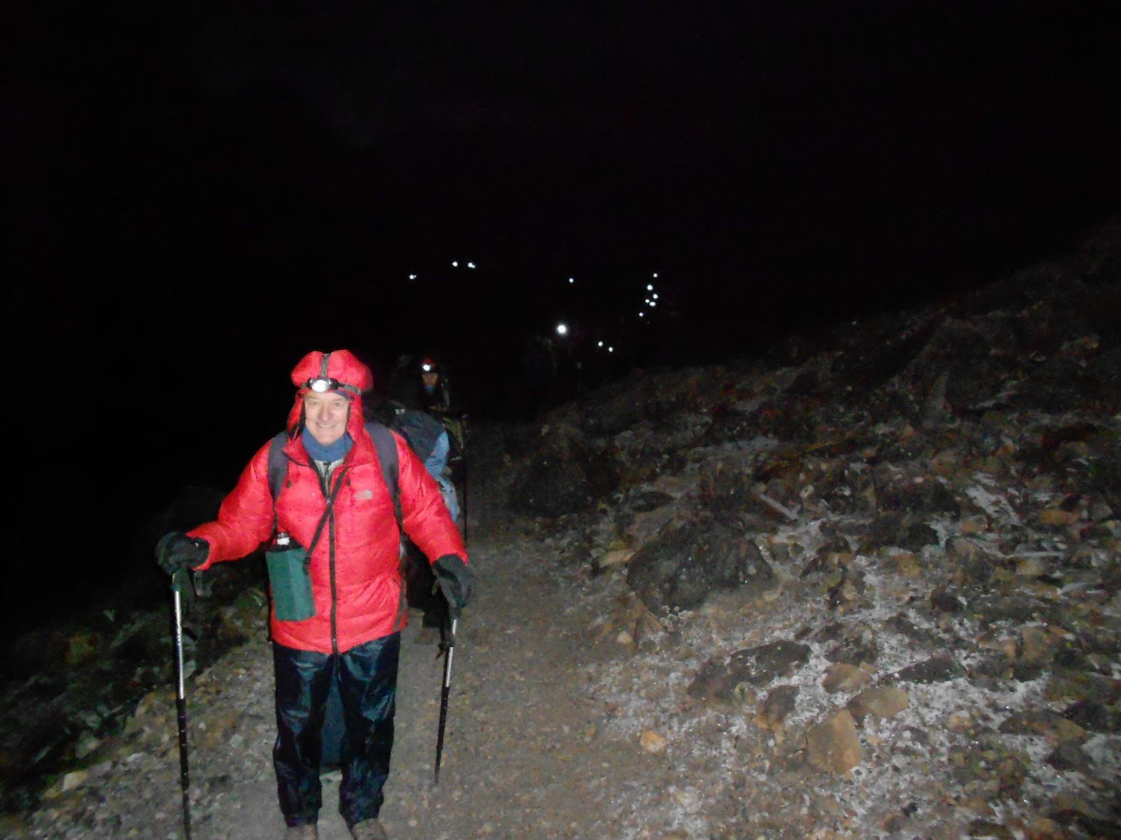
At breakfast I got chatting to a young English guy who we’d met back in Manang. Jason had completed the trek from Thorung Phedi to Muktinath in 6 hours, including a 30-minute stop at the summit for tea. He must have been supremely fit. We were a far cry from this: our traverse from High Camp had taken our team nearly 13 hours and had exacted quite a toll physically. The previous evening we’d thus agreed to proceed to Jomsom by jeep where we would travel south by bus to Tatopani. Dreams of Annapurna Base Camp were now well and truly buried.
The decision also meant that we would be bypassing the ancient fortress town of Kagbeni, gateway to upper Mustang. I was bitterly disappointed as I was eager to see the region’s unique geography and learn something of its legendary horse culture. It would have been a poor man’s substitute for a trek into the fabled upper Mustang region itself – a highly sensitive and restricted area that very few people get to see unless they have a lot of time, luck and money. The area is still, at least to some degree, shrouded in mystery and intrigue. Politically, it was the setting for the last and tragic stand of the CIA funded Khampa Rebellion that sought to wrest control of Tibet back from China. Culturally, many of its people continue to live under a highly conservative strain of feudal Bhuddism, very similar to that which prevailed in Tibet before the Chinese took over. Ecologically, it is the last frontier for a variety of endangered terrestrial and avian species including the Lammergeyer and the Snow Leopard. A two-week trek permit for this ecologically sensitive area is not only hard to secure but is currently priced at $700. Visitors must complete a register of all consumables they are carrying in as well as show that they have sufficient butane canisters as an alternative energy source to wood. Packaging for every item on the register must be checked back in with the authorities upon conclusion of the trek.
It was a short walk down to the western end of Muktinath where we joined the lines for a jeep to Jomsom. While waiting, I examined a table of black, spherical rocks the likes of which I’d seen on sale the previous evening in the high street. They turned out to be ammonite fossils, locally known as saligrams and considered by Hindus to be sacred symbols from Lord Vishnu. The stones are kept in temples, monasteries and households while water in which they have been soaked is drunk daily. They are also used ceremonially in marriages, funerals and house-warmings and the dying person who drinks saligram-steeped water receives absolution and the right to dwell with Vishnu for eternity. This brazen selling of saligrams, particularly in such vast quantities, is not strictly compliant with Hindu tradition. Moreover, when one considers the number of pilgrims and tourists who pass through, the impact which fossil harvest is having on the local environment must be significant.


In order to fill our jeep, we’d mingled in the dining room of our hotel the night before and recruited trekkers who were as desperate as we were to take some weight off their feet for a day. Our vehicle thus contained a motley crew of injured travellers and their retinue of guides/porters. Amongst others, we made friends with an Israeli couple, Nadav and Dana Sherman. Nadav, a developer for Google in Tel Aviv, was suffering from ITB after the intense downhills of the previous day and could barely alight from the vehicle without wincing in agony. Dana’s knees weren’t much better. Seven of us squeezed into the back of the jeep while the remaining 6 sat up front. Crammed into this confined, tinny space and inhaling a nauseating swill of fine dust and diesel fumes, we rode the waves of motion sickness as the vehicle flip-flopped its way through the 1000 metre descent into the Kali Gandaki Valley.

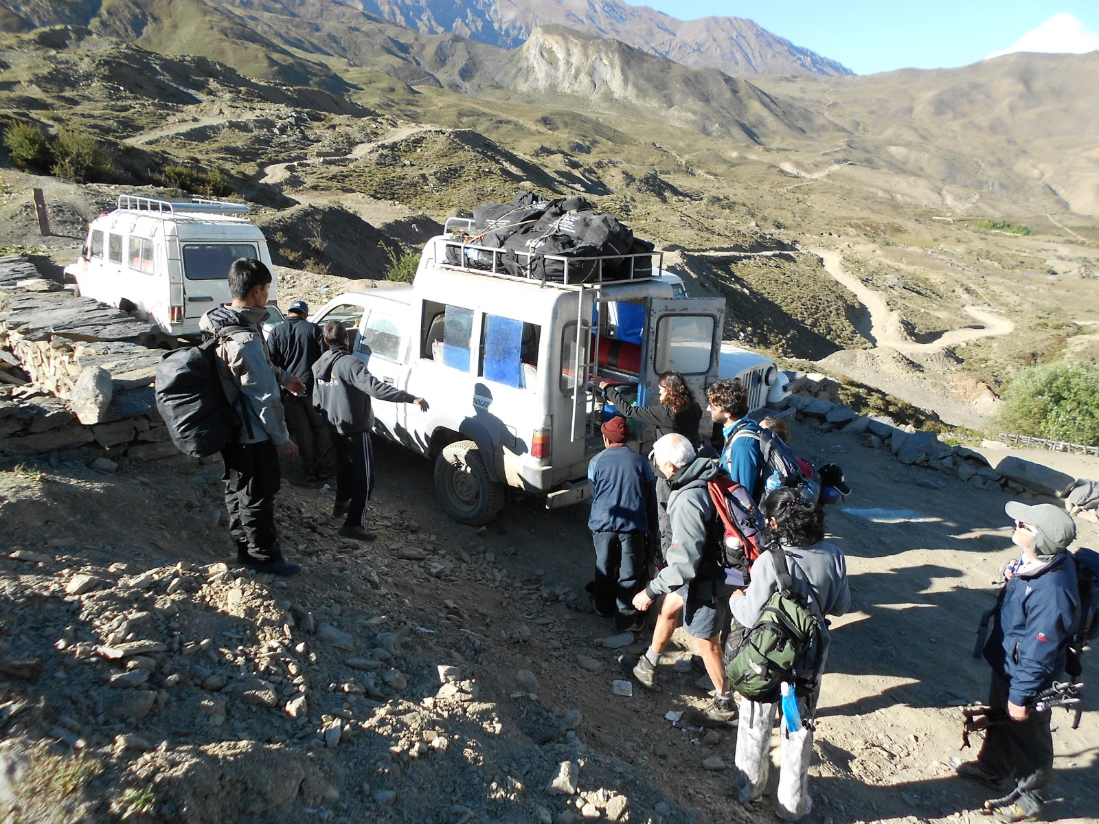
Boarding the Jeep to Jomsom - everyone in picture crammed into that vehicle

Saligrams for sale in Muktinath

Admiring the Mountain fastnesses of Lower Mustang - Kagbeni can be seen beyond the apple orchards in the distance
At a lookout point halfway down, we took a break. Some retched uncontrollably into the bushes while others admired the stony immensity of Lower Mustang. The river plain combined with its lush apple orchards and surrounding ampitheatre of snow-capped peaks and gravelly hills are so vast that the place almost swallows anything which ventures into its depths. I felt desperately cheated to be seeing it so fleetingly. I equally regretted our short stay in Jomsom, a clean and well-ordered town that rests in the shadows of the great Dhaulagiri group. But we were in such a rush to catch our bus that there was little time to do more than have a quick bite to eat.
*
It is the work of a moment to look at the map and say: “it looks like we can take public transport down to Tatopani – and it shouldn’t take much more than half a day”. The first time visitor should not be criticized for this: the road, on the map at least, looks fairly straight and the distance appears short.
But all this is to ignore the fine print of the contour lines, the seed, (once again in our case), for gross miscalculation. You’d think we’d have learnt from our grinding ordeal on the trip from Khatmandu to Syange. In truth, we remained howlingly naïve. We thus blundered into our rest day blissfully unaware of the adventures that lay ahead of us – of the almost seismic shift in altitude between Jomsom and Tatopani (about 2600 metres over a linear distance of 40 or so kilometres). Of the inconvenient fact that we were at the tail end of a particularly generous Monsoon and that the hills were as saturated as a wet chammy leather. Of the woefully slim choice when it came to choosing public transport…
Nepali busses, besides their gay and garish exteriors, must surely rank amongst the most nefarious inventions known to man. Egregiously maintained, their interiors have been built with the stature of the locals in mind. On the way to my seat I counted (through painful experience), at least 6 points of interruption between the ceiling and my head. Furthermore, the coaches have the most rudimentary of sound systems that pipe an incessant and grating cacophony of weird and wonderful Hindi and Nepali music into the cabin.
Our bus trundled out of Jomsom at about 11 o’clock heading South into the ever-deepening Kali Gandaki valley to Marpha – where we stopped to buy freshly picked apples. Marpha’s chief export is apple brandy and I was impressed by the town’s quaint distillery. As we left Mustang behind us, the barrenness was quickly replaced by imposing stands of pine and juniper. At three, we experienced the first disruption to our journey. The road ahead was so bad we would have to disembark, retrieve our luggage from the roof and hike two kilometres to the next town where we would find another bus. Everything about this changeover seemed fairly routine until we got caught in the mad scrum to board the new bus. Let’s just say it nearly got violent.


Apple stop at Marpha

Bus change in the Kali Gandaki - The World's deepest Gorge
The second bus journey was a terrifying ordeal. Though a considerably shorter leg, a vehicle designed to hold no more than 30 passengers now held upwards of 60. Moreover, the road now descended into the business end of the world’s deepest river gorge. Often hideously close to the void, our bus seemed to defy the laws of physics as it hared through the bends and switchbacks. When we disembarked half an hour later I noticed that one of the back tyres had shrugged off its re-tread and was down to the canvas.


What you see here is not dirt but canvas
The relief of terra-firma was short-lived however. It was nearly five o’clock and the last bus of the day was due to leave the next village in 20 minutes. If we missed that, we would be forced to camp in the open. This triggered a desperate footrace through the gorge in which all 70 passengers of the previous bus participated. The field arrived in the next hamlet more or less as one though just in time to see the bus in question disappearing around the next bend. A collective groan rose above the village though hopes were restored somewhat when a local trader said he thought another bus would be through at any moment.
An hour later we were still waiting. The crowd slowly thinned out as locals returned to their houses and a few trekkers shouldered their gear and headed off down the road to the next village. We said goodbye to Nadav and Dana.
At 6.30, just as we were entertaining thoughts of our own night hike, a jeep in hideous state of disrepair laboured noisily up the hill. There was a grinding of gears as it stopped in front of the store. As the driver emerged, Raj flew hastily into action. After an animated conversation our guide and the driver disappeared around the corner for a few minutes. I cannot say what went on there but I imagine a lot of money must have changed hands. Ten minutes later, the jeep was loaded and we were ready to go. A pair of young Israeli girls joined us, one of who was suffering from a ruptured eardrum. We left the settlement much relieved.
As is usual with the roller coaster nature of road travel in Nepal, there were more thrills in store. I peered through the windshield, seriously obscured by tassels, trinkets, carpeting and stickers of Bollywood actresses. The night was closing in quickly and visual perception for the next hour would be confined to opportunistic glimpses, mostly as the vehicle tilted to one side. What I do remember was a waterfall so colossal that I thought I was hallucinating. If it weren’t for Martin’s cry of amazement at seeing the same thing I would still think it a mirage. Will I ever behold such an awe strickening sight again I wonder? It consisted of at least 4 separate cataracts, the last of which thundered into a pool through which the road passed. From there, the river turned downhill and followed the road. We drove with water up to the wheel bolts for nearly a full kilometer.


View from the front seat of our jeep
Just as it got pitch dark, our driver stopped the car, turned to me and said: “I’ll on the lights!” Why, I wondered, the need to stop the car? It turned out that the lights in question had to be actually fastened ON to the car. A roll of masking tape was produced and our porters got out to offer advice. One of our Israeli friends commented that on a previous jeep ride in Chitwaan Game Reserve, the headlights had been so weak that the driver asked his passengers to climb onto the roof and use their headlamps to light the way. At least in our case it never came to that.
At 8 o’clock, the jeep stopped in the midst of a heavy downpour outside our lodge in Tatopani. We were too tired and shell-shocked to even feel relief. At 1100 metres, we were now firmly back in the tropics. The air resounded with the shrill chirruping of cicada beetles and the angry roar of the river. The contrast with the past five days was surreal.
Three hours later a bus descending from the village of Rupsecchhahara (where we’d commandeered our jeep) failed to negotiate a decisive bend in the road and sailed headlong into the inky darkness of the Kali Gandaki. Miraculously the occupants, a driver and his conductor, escaped with their lives.
It could so easily have been us.