Showing posts with label Yak Kharka. Show all posts

Thursday, 25 October 2012

To Thorung Phedi and High Camp

The three days from Manang to High Camp were characterized by a series of relatively short treks, punctuated by long periods of inactivity at our destinations.  While the “rule of threes” prescribed an ascent of no more than 300 metres a day, the contour interval between settlements made adherence to this tricky.  Fortunately, trekking time was now truncated to no more than 5 hours a day (at worst) though in places the physical exertion was even higher than it had been on day two.  I found negotiating suspension bridges a particular challenge.  Setting a rhythm on the trail proved relatively easy – a simple plod stabilised by ones trekking poles ensured minimum expenditure of energy.  But bridges were another matter.  For one thing, they had a tendency to sway just enough to knock one off one’s rhythm.  For another, the “downhill” part of the traverse was soon followed by a curiously taxing incline that sapped the lungs and made the muscles smart.  Invariably, the exits to suspension bridges were bottlenecked by heaving pelotons of huffing, puffing trekkers.
  
Typical dwelling of the Manang area - wood is piled up on the roof in anticipation of winter.  Such piles are an outward sign of wealth, prestige and status in the community

Travelling above the tree line, we now beheld a form of alpine desert where the rocky ground sustained little more than a species of coarse grass (upon which the Yaks and Musk Deer graze) and a ubiquitous thorny scrub called Seabuck Thorn.  The plant bears a perennial orange berry that is said to contain the highest concentration of vitamin C and Lycopene in the plant kingdom.  This fruit is painstakingly picked, mashed to a pulp and strained by hand to distil a bright orange juice.  The splendid beverage is served hot to thirsty trekkers and is the closest I’ve seen to magic potion.  Three days later after the harrowing descent from the Thorung La to Muktinath I sampled a cup and felt the life returning with almost every sip.  My only regret is that I didn’t discover its life giving properties sooner.


Men churning Nak milk

Yak Meadow near Gudrung

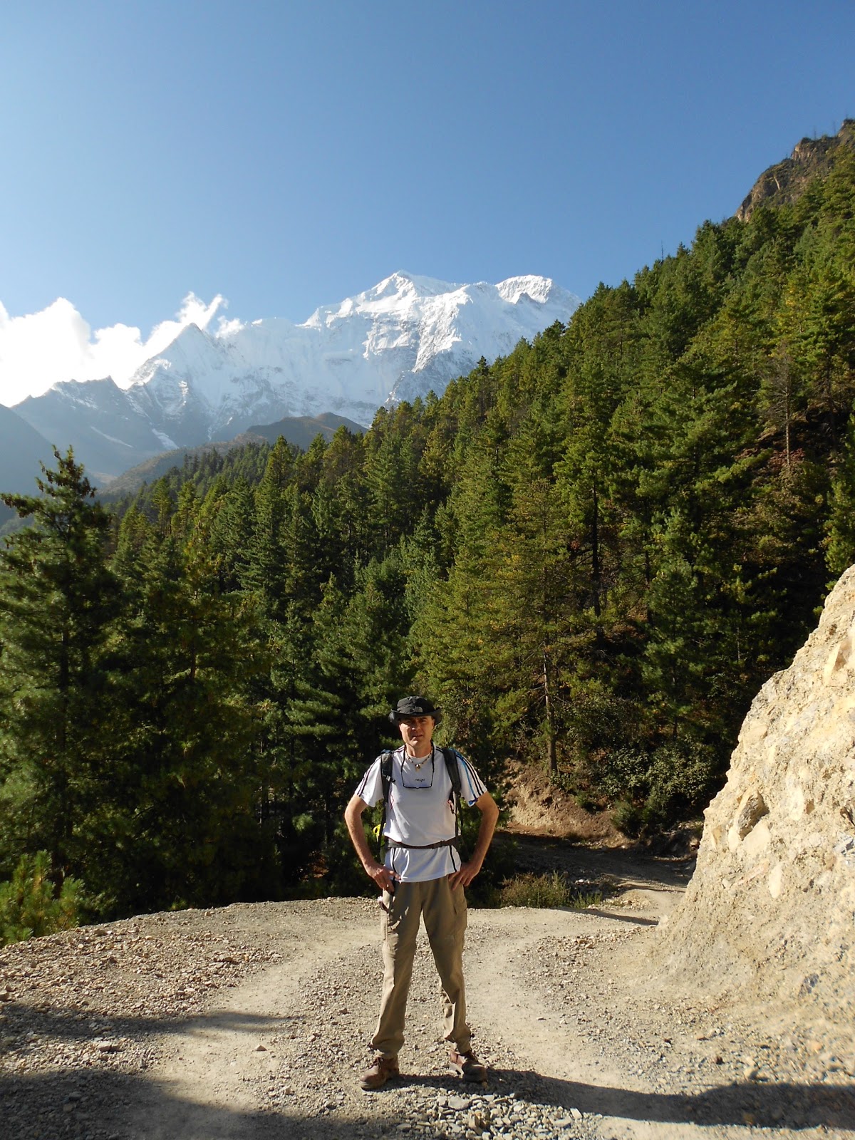
Tea break with Gangapurna in the background

Dutch trekker Sander and his guide Tilak

Another memory of this leg was the increasingly spartan nature of the villages we encountered.  Lodges were increasingly exposed to the elements and we quickly layered up against the escalating cold.  Upon arrival, we would eat lunch and then rest up on our beds, reading and chatting.  Though the morning weather was invariably pristine, afternoon activities might be curtailed by low-lying cloud, high winds, sleet and in places, light snow.  The enveloping cloud had a distorting and spooky effect on sound too.  The soporific clanging of bells announced the occasional passing of yak, pony or donkey trains and occasionally the mournful cry of a Yak grazing high up amidst the gloom jerked one from one’s slumber.  

Whiling away the time

Men and Ladies Toilets - denoted by the skulls over the doorway

At lunchtime of Day 8 we arrived at Thorung Phedi, Nepalese for “The foot of Throung Mountain”.  This remote base clings to the edge of a lonely but spectacular gorge containing the Kone River.  The river was a mere trickle at this time of the year but judging from the high water markings had the potential to be a thundering behemoth in spring.  To get to Thorung Phedi we had to negotiate a tricky landslide belt through which the ribbon like path intersected towering, flinty screes.  A fall here might not have been fatal but it would have put an end to one’s trek.  Indeed, one of Sandra’s ward mates in Kathmandu was an Australian who’d fallen while taking a pee one night.

Entering the Landslide belt at Thorung Phedi - it took an hour to walk to the point where the path disappears in the distance

The barren outpost of Thorung Phedi

The dining room at Throung Phedi was a hive of activity.  Because there was little else to do (and the bedrooms were spartanly furnished and cold to boot), complete strangers came together over endless games of cards and chess as well as discussions about reading material, philosophy and politics.  From about lunchtime to 10 o’clock at night, there was no rest for the long-suffering kitchen staff who ferried a constant stream of steaming meals and hot beverages to hungry trekkers.  I was impressed at their efficiency in spite of the most rudimentary kitchenware.  While not fine dining, meals were completely wholesome and mostly delicious.  Anything containing pasta, tuna, rice or potatoes was in high demand and noodle soup was ladled up by the gallon. 

The owner of the place struck me as a fairly urbane fellow having installed an advanced sound system in the dining room which, linked to his iPod, played such artists as Bob Dylan, The Rolling Stones and Eddie Vedder.    He also owned a dog of non-descript breed that he lovingly referred to as “Puppy”.  The dog is one of the most photographed and videoed animals in the region and thanks to YouTube, I knew all about him months before leaving home.  Though 15 years old now, “Puppy” is famous for accompanying trekkers over the pass and staying with them as far down the other side as Muktinath.  In his old age, his fur is terribly matted and a veritable treasure trove of burrs and Seabuck berries.  Still, he seems content and is universally loved by trekkers.

Mountain Dog

The main topic of conversation between trekkers however, was on the best strategy to traverse the Thorung La.  Was it better to climb the 1000 metres to the summit in a single day, followed by the 1500m descent to Muktinath?  Or was the more prudent option to ascend 850 metres to High Camp, sleep there and then attack the pass?  Surrounded by hundreds of opinions from people who’d never done the trek before, I discovered quickly that there was no right answer.  What helped swing it for us was the fact that option 1 is generally regarded as an 8-hour walk.  Take our persistent defiance of gazetted walking times, couple that with the effects of the cold and altitude – throw in the fact that at least half of our team was the walking wounded - and it would be quite possible that the journey from Thorung Phedi to Muktinath would become a grim fourteen hour route march.  There was no choice but to stay at High Camp.

The dining room 

Next morning, the real climb began in earnest.  On a straight line, the distance from Thorung Pedi to High Camp is probably no more than a kilometer.  But in the Himalaya, only a debutante measures distances in kilometres.  Though the climb was only meant to take 45 minutes, we took plenty of water breaks and did it in 90.  We were also blessed with a sighting of a herd of musk deer, an increasingly rare sight in these hills.  The weather turned early that day and we arrived in the dining room of High Camp just as it began snowing.  As was the case in Thorung Phedi, we spent most of the day socializing in the dining room over hot drinks and food.  Early that afternoon, I joined Raj and an American trekker named Fred on an acclimatization climb to a nearby viewpoint.  From the top, we looked down a full vertical kilometer to the lodge we’d slept in the night before.  By now there was no greenery at all – High Camp, a forlorn pinprick in a moonscape of bald, serrated hills, snow-clad mountains and frigid glaciers.  

Thorung Phedi from High Camp - 400 metres below

It was cold - High Camp far below

This, for me, was the real Himalaya and I was exhilarated to be up this high.  Though I may never climb to the treacherous heights of an eight-thousander I felt for the first time that I’d earned a small place in the great mountaineering stories I used to devour as a kid.
*
I woke up to the muffled clanging of horse bells outside my room.  The door creaked open as Martin returned from a trip to the toilet.  I looked at my watch:  3 o’clock.  Time to get up.  Our bags were mostly packed so getting ready was merely a question of stowing our sleeping bags – (we’d slept in our clothes to avoid the fuss of dressing)

“It is very cold tomorrow” Kisna had prophesied in his broken English when he said goodnight the previous evening.  And he wasn’t wrong.  In fact, it was already snowing.  After a nervous breakfast of oats porridge, we adjusted our headlamps, said a quick prayer and began the march to the summit.


Wednesday, 24 October 2012

Rest Day in Manang

We were entering what I consider with hindsight to be the most photogenic crescent of the Annapurna Circuit.  What struck me was not only the sheer diversity of the subject matter but the density of it too - strange and fantastical geological formations, wooded valleys of blue pine and juniper, serene meadows, artisanal wooden bridges spanning rushing rivers.  All this scenic generosity juxtaposed against cobalt blue skies and boiling phalanxes of cloud made the memory of our third day one I will treasure for a long time to come.  


Trekking near the Swargadwari Danda - the photos hardly do this place justice

At the epicenter of this marvelous region was the village of Dhikur Phokhari, immediately recognizable for the gigantic sweep of the Swargadwari Danda – a severe rock face which towers over the town.  It resembled a gargantuan tidal wave which aeons ago was on the verge of pulverizing the valley before the creator uttered the words “this far and no further”.  The 1500 high metre wall was visible for the majority of the walk from Koto to lower Pisang though some of the best views could be seen from the road that meandered through the forest beyond the town.

The day would have been perfect except for the fact that I had a pounding headache by the time we reached Pisang, 3200 metres above sea level.  I made a mental note to escalate my water intake and to commence my course of Diamox that very night.  After checking into the guesthouse, I followed the trail out of town to get a better view of the sunset.  I stood for a while and examined a primitive yet fully functioning aqueduct fashioned from hollowed out pine logs.  It was brimming with fresh water diverted from the river higher up the trail and though ancient was undeniably elegant in its simplicity.  I crossed the river and scrambled up the hill.  On the crest stood a memorial to an ill-fated Japanese expedition that had perished some years ago on the slopes of Annapurna IV.  High above the forest, the peak in question luxuriated in a glorious burst of alpenglow – almost too beautiful to be dangerous.


Dusk outside Pisang

That evening in the dining hall, it was obvious that I wasn’t the only one concerned about the effects of altitude.  Indeed, the higher we got the more fixated about it we became.  We were unanimous that the trail had been harder than anticipated and keenly aware that our progress had been painfully slow.  Stretches which should have taken 6 hours or less to complete were taking 8 hours or more.  But it wasn’t until Raj said that we would need more days to successfully negotiate the Thorung La that things really got really heated.  Some lamented the obvious implications: the trip to Annapurna Base Camp would either be an unpleasant rush or even impossible.  After much debate on how to reset our itinerary, we agreed not to re-visit the issue until our rest day in Manang.  Of one thing we were all agreed however: no one wanted to retrace the trail to Sangye.  There would be only one way and that was up.


The following day, the walk through to Manang was one of the most relaxing we had had to date though conditions were very dusty and the glare off the road’s clay surface intense.  Much as I enjoyed the day, I was irritated to discover when it was too late that there were two routes to Manang and that our guide, assuming we weren’t fit enough for the higher more scenic one, had remained silent on the issue and defaulted us to the tamer route.  It was a Swedish Doctor we met near Humde who let the cat out of the bag, expressing amazement at our choice.  Though she didn’t elaborate, we knew we’d drawn the short straw.  Still, had it not been for this, we would not have been in a position to sample the baked delights of the Humde and Manang valleys where the locals have developed quite an expertise in the fine art of patisserie.  At Humde airstrip we purchased cinnamon buns from an old lady by the roadside and at Braga sampled freshly baked carrot cake.  These items were surprisingly good and a welcome break from the artificially sweetened biscuits that up to now had accompanied our tea breaks.

The Humde Valley - the airstrip is temporarily out of action as they are tarring it - (probably bad news because it will mean more flights and thus more tourists)

Making friends in the Humde Valley


 We arrived in Manang shortly after lunch.  At 3500 metres, the town is a good place to spend a rest day and most trekkers spend two nights there.  Because of this, Manang is a good deal more cosmopolitan than other places we’d stayed.  The cobbled streets are lined with souvenir shops, outdoor stores, book exchanges and a few very good coffee shops and bakeries selling such brands as illy and Lavazza.  The town even has its own movie house that constantly loops the same 6 films.  They are:

“Into the Wild” and “Into Thin Air” (inspired by the John Krakauer books)  
The Nepalese art nouveau classic “Himalaya”, 
The gripping mountaineering docudrama “Touching the Void”, 
“Slum Dog Millinear” (sic) and 
“The Hangover” (of all films!).  


The movie house has its own fireplace, seats covered in Yak hide and guests are served fresh popcorn and hot tea.  It’s all a very nice touch indeed.  Manang is also the headquarters of the Himalayan Rescue Institute, housed in a ramshackle cottage at the entrance to the village.  Here, trekkers can attend free daily talks on mountain sickness and have their oxygen levels tested for $10 a pop.  We attended one such talk and found it both highly informative and entertaining – if not a little unnerving.  

After a good night’s sleep and the prospect of a full day’s rest, everyone was feeling a lot better.  I went shopping and bought trekking poles having neglected to get some in Khatmandu.  Eager to try them out, I convinced Raj and the others to join me on an acclimatizing walk up to Chongkor Point (3800 metres) on the other side of the river.  The point is at the summit of a massive hill that overlooks the Gangapurna Glacier and lake.  

Led by two of our porters, we set off just after breakfast.  The downhill section to the river led through Manang’s primitive stone town where the sanitation was gossamer to say the least.  I quickly named this septic area “poo alley”.  Fortunately the uphill section to Chongkor point was a lot easier than it looked from the other side of the valley and though the views of the glacier and the lake were spectacular, they were alloyed somewhat by the prospect of the descent.  No one was looking forward to a knee pounding – or to the miasmic sludge of “poo alley”.   But in the event we coped just fine.  

Technology comes to the Annapurna Region

Gangapurna Glacier

Amongst Manang’s many acclimatization walks is an excursion to a monastery situated on a barren hillside 800 metres above the village.  The place dates back to mediaeval times and is inhabited by a Buddhist Lama who for the sum of 200 rupees will impart a blessing to his visitors.  A fellow trekker who went there told me that the Lama is 94 years old and that he last came down to Manang more than 30 years ago.  He is attended by his 64 year old daughter who descends to the town once a week to purchase food and other supplies.

The rest day did me good and and though Manang was a bit on the busy side and our hotel a little too grubby for my liking, I found the valley enchanting.  In the rarefied air, the mountains seemed so close you could reach out and run your hand along their icy slopes.  I was also taken by the industriousness of its people and the “all hands on deck” urgency they brought to harvesting the ripened wheat crop.  From before sun up to well after dusk, people of all ages pressed into the challenge associated with cutting, bundling, carrying and threshing.  I suppose the spectacle should have inspired a sermon on Matthew chapter 9!  

The only concern was Sandra’s condition.  Her flu had actually gotten worse in spite of her day’s rest.  Surprisingly, a British doctor form the Himalayan Rescue Institute had given her the all clear to ascend, providing she did so slowly.  Our decision regarding itinerary had practically been made for us.  Our next overnight stop would be Yak Kharka, 400 metres higher than Manang.

The beautiful Manang Valley


Friday, 19 October 2012

Yak Kharka Village, 4050m – Day 7

I shoveled the last few spoonfuls of porridge into my mouth and took a sip of water to wash down a cocktail of multi-vitamins and half the daily dose of the mountain sickness drug Diamox.

“It’s time we made a start,” I said to Martin, looking at clock on the wall behind me.  “We can’t wait for the others”

“You can start but move slowly,” said Raj the guide.  “I will wait for the others and we’ll catch up with you in Ledar - but wait for us there” 

We shouldered our packs, made a few adjustments to our trekking poles and gazed up the street towards the trail, still heavily shrouded in mist and the shadows of the surrounding peaks.

Though this was supposed to be one of the high points of our journey I felt despondent and a bit anxious.

For one thing, it was considerably colder this morning than it had been in Manang, the town one day’s walk behind us in which we’d spent two nights and enjoyed a full rest day.  For another, though there’d been enough water for a shower, none of it was hot enough to bathe in and it would likely be days before we smelled decent again.  

Moreover, neither Martin nor I had slept well, each complaining that the other had snored.  A mouse had found it’s way into my bag and had spent the night gorging itself on a packet of Future Life cereal.  

I felt a bit lonely too I suppose.  Late the previous afternoon, Sander – a Dutch traveller with whom I’d gotten pretty friendly during the last 5 days - had raced through Yak Kharka with his talkative guide Tilak saying he needed to make more ground before nightfall.  The last time we’d chatted was over tea earlier that morning on the roof of a spectacular mountain facing tea shop in Ledar.  Sander was now headed for the higher reaches of the trail at either Thorung Pedi or Thorung High Camp.  I thought he was silly but, with hindsight, it was a slight feeling of sadness in seeing him go.  I waved a friendly goodbye nonetheless.  It would be the last time we’d see him on the Circuit.

As Martin and I headed out of Yak Kharka (Nepalese for “the Yak Meadow”) – I looked down at a stone-walled field where the previous day, a Brazilian named Andre and I had gone to get a photograph of a magnificent jet black Yak bull.  Andre had come to Nepal hoping to walk to Everest Base Camp but, after the Lukla bound plane went down the previous Friday killing all 19 people aboard, authorities had closed the flight paths into the Everest region indefinitely and he was forced to change his plans.  At the last moment, the Brazilian fell in with a trio of Israeli youngsters who had just completed their military service and were looking to stretch their legs beyond the borders of their troubled homeland.  

The Yak in situ promised to be the perfect shot – a mountain backdrop complete with iconic Himalayan beast of burden in the foreground.  All went smoothly until Andre decided that the best way to get a head-on view of the beast was to pelt it with stones.  Oh Andre got his picture all right…but things rapidly deteriorated from there.  Reflecting on the event later, Andre would say that anything was better than wasting time with his Israeli companions who he said only wanted to sleep, play cards and smoke the hookah.


To cheer myself up, I plugged in my earphones and listened to Matt Redman’s “10 000 Reasons” from start to finish.  The words seemed all the more significant out here in this exposed environment.  For a while I walked in a contemplative bubble, focusing only on the lyrics and on the hypnotic rise and fall of Martin’s boots.  

But the cold and shadows persisted, a reminder of the heights to which we had already come and the 1500 meters we still had to ascend if we were to successfully cross the Thorung La.  

Not for the first time I felt a rising tide of guilt.  Our initial itinerary had us flying into Jomsom (2700m) and taking a leisurely (and tamer) trek downhill, turning off at Birethanti to visit Annapurna Base Camp.  Several weeks before leaving however, I’d heard from various sources that this side of the circuit had been heavily compromised by a new road and besides, was not nearly as scenically impressive as the northern sector.  I’d thus pushed most heavily (and successfully) for a switch of itineraries that would skim the cream off the circuit - the leg from Besi Sahar to Jomsom followed by a bus trip to Birethanti where we would turn off and spend the last 6 days climbing to Annapurna Base Camp. 

I’d naively overlooked the fact that the northern sector is the far tougher and more isolated sector.  I’d minimized the effects of the altitude and physical demands of crossing the Thorung La (at 5400 m, nearly as high as Kilimanjaro).  I’d made light of the fact that Martin was not only too old to get special insurance cover for this journey (he is 74) but that he’d had knee surgery just 3 months before coming.  (In fact martin only made his final decision to come 9 days before we travelled).  In reality, though a veteran of 7 Kilimanjaro ascents and a trek to Everest Base Camp 4 years ago, this was always going to be a tough outing for him – a week earlier I’d watched him limp uncomfortably onto the plane in Durban and wondered how he’d ever get through the next 21 days in one piece.  

Then there was the fact that few members of our team had ever climbed under their own steam to 3000 metres and that few had done any serious strength training for the walk.  

Lastly, there was Sandra who had been battling with flu symptoms and a pounding headache for nearly 3 days.  In the face of overwhelming evidence to the contrary, a British doctor in Manang had given her the all clear to move up the trail provided she did so slowly.  

The guilt had first surfaced 3 days earlier in Pisang but had intensified as we climbed higher.  Now as we moved deeper into the shadows of the great Thorung and Chulu Peaks, it threatened to overwhelm.

As I packed away the iPod, a familiar pins and needles sensation returned to my toes and fingers, a condition the locals refer to as the Djhum Djhums.   They were a side effect of the Diamox pill I’d taken an hour or so earlier.  While a completely harmless sensation, it was intense enough to be un-nerving.  

I’d read in Lonely Planet that reports of high altitude sickness on the Thorung La were “greatly exaggerated” and that the majority of people successfully avoided it (or at least experience only mild symptoms).  While this may be so, the fact remained that Acute Mountain Sickness (AMS) was affecting people all around us.  In the past few days we had passed a number of patients being rushed to lower altitudes on horseback, clinging for dear life to either mane or saddle while a tribesman ran alongside, $120 the richer for his exertions.  Daily helicopter sorties hinted at more serious cases.  A talk by a world expert on AMS named “Dr Tom” at the Ramshackle Himalayan Rescue Institute in Manang had highlighted the risks, clarified the symptoms and scared most people witless.

As a team we were nothing if not careful - surely we’d be fine?